New National Highways Required for Bangalore
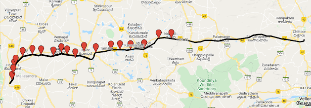
1. Bangalore - Chintamani - Chelur - Kadiri - Nandyal - Atmakur
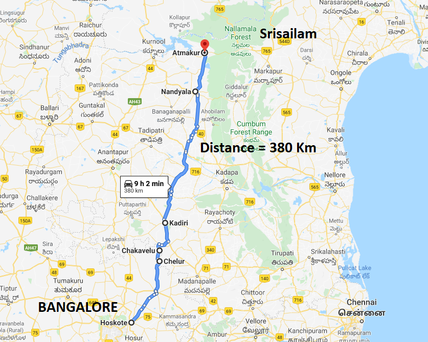
The
highway should commence at Hoskote and continue towards Chintamani, which
currently is SH 82. Hoskote, Pillagumpe, Nandagudi, and H-Cross are poised for
industrial and residential development as they are a part of the Bangalore
district.
Kaiwara
temples, Kaiwara National Park, the temples of Chintamani (Kailasagiri,
Murugamalla, etc), would be along the way. From Chintamani, the highway would
deviate towards Chelur (Bagepalli taluk), a border town. Chakavelu would be the
last town within Karnataka.
One
visit to Kadiri, Nandyal, Ahobilam, and Srisailam would reveal the number of
people from Karnataka visiting these temple towns. Merchants from Tadipatri
(clothing) and Banaganapalli (mangoes) do travel to Bangalore for business
purposes.
Hence, creating a national highway and
also laying a railway line along this route starting from Whitefield and
passing through Hoskote, Chelur, etc. would boost economic growth in the region.
This line would be more beneficial to Karnataka than the proposed Kadapa-Bangalore
line that only proposes to help AP by linking the Pakala – Penukonda line to
Bangalore.
2. Bangalore - Chintamani - Madanapalle - Pileru - Tirupati

3. Nelamangala - Hebbur - Turuvekere - Nonavinakere - Tiptur

This road may not be required
immediately, but when we think of the rate at which the Kempegowda
International Airport is growing, it makes sense to ponder over whether the
airport area can accommodate the third and fourth terminals.
Located almost 56 Km away from KIA
and well connected by major roads including the upcoming STRR, the region
between Nelamangala, T-Begur, Kudur, and Solur would be ideal for the second international
airport for Bangalore. If such a thing can materialize, then the existing roads
between Nelamangala and Tiptur can be developed into a national highway. Not
only would it cut the distance between Bangalore and Shimoga, but also connect
towns like Gubbi, Nittur, KB Cross, Chikkanayakanahalli, Tiptur, etc., to the
new airport.
Comments
Post a Comment